The Entreovejas River: a mountain stream between Bárago and the Frío
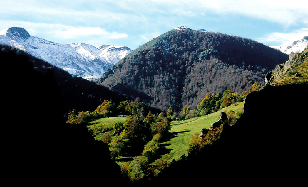
Contextual view of the Ranes winter farmsteads and Cantabrian Mountains from Cucayo. The photograph does not show the Entreovejas River. LBM1948, November 2004, CC BY-SA 4.0, Wikimedia Commons file.
The Entreovejas River, also called Arroyo Entreovejas or Río de Entreovejas in different sources, is a short mountain stream in the municipality of Vega de Liébana. Its importance lies less in its length than in the way it links the pastures and forests of Bárago with the Frío River, and in the historic path crossing its valley between Bárago, Dobres and Cucayo.
Mountain headwaters, with no spring identified
The Government of Cantabria’s hydrographic layer maps a stream of approximately 2.87 kilometres on the high slopes above Bárago. Its upper section lies below the Pico Corcina area. A botanical observation record notes the place-name “Entreovejas, below Pico Corcina” in the same area. This helps locate the landscape but does not identify the point where water emerges. The headwaters are therefore described as an area of runoff and small mountain streams, not as a known individual spring.
The terrain combines steep slopes, rocky outcrops, meadows and patches of woodland. Local route descriptions mention oaks, poplars, ash trees, walnut trees and chestnuts along some sections. Visible water levels change with rainfall, snow and summer low water. Reports of small cascades do not mean they flow permanently or that a developed path reaches the riverbank.
From the Las Retuertas path to the Frío River
The Vega de Liébana Town Council route Bárago–Las Retuertas–Cucayo gives the clearest description of the accessible section. It leaves Bárago beside the parish church, passes near the cemetery and crosses meadows with apple trees to La Cotera. From there it descends through oak and poplar woods to the Entreovejas. The municipal guide describes a small riverside clearing with walnut, chestnut and ash trees.
After crossing the stream, the route climbs steeply through Los Fresneros and the bends of Las Verás, La Posa, La Cueva, La Cruz and La Polea towards Collada Ladobo and Collada de las Ánimas. It continues through the oak wood of La Bodija and descends towards Cucayo, where it reaches another watercourse: the Frío River. This crossing of the Frío should not be confused with the Entreovejas mouth. The first is part of the path to Cucayo; the latter is the hydrographic confluence downstream.
The Cantabrian Hydrographic Confederation identifies the reach of the Frío from the Cucayo-Dobres hydroelectric plant to its confluence with the Río de Entreovejas. This official reference confirms that Entreovejas is a tributary of the Frío. From the confluence, the water flows along the Frío to the Quiviesa at La Vega, then down the Quiviesa to Potes and finally along the Deva towards the Bay of Biscay.
The regional mapping depicts the watercourse towards Bárago and the Frío, but does not by itself establish the name of every minor headwater, the precise bank of its confluence or a natural hydrological length. These details remain open until confirmed by a detailed hydrographic source.
Tributaries
No reliable list of named direct tributaries has been found. Mapping shows small gullies and slope runoffs, common in a mountain stream, but these should not automatically be described as named tributaries. This guide therefore records no confirmed named tributaries. The Frío is not a tributary of the Entreovejas: it is the receiving river into which Entreovejas flows.
What to see beside the river
- The Entreovejas crossing on the Las Retuertas path: the municipal route reaches the stream along the old path between Bárago and the former council area of Dobres. The guide recounts how hay from mountain pastures was carried along this route on basnas, traditional pack frames. A possible Roman origin for some paved sections is presented in the local description as a hypothesis, not a confirmed archaeological date.
- The riverside clearing: the town council highlights the walnut, chestnut and ash trees beside the river. It is a stop along a mountain route, not an equipped recreation area or signposted bathing place.
- Collada de las Ánimas and La Bodija woodland: these landmarks on the same route show how the stream fits into a network of old paths, pastures, villages and forests. Dobres and Cucayo can be seen from the pass.
- Bárago and Cucayo: Bárago is the town council’s recommended starting point. Cucayo lies beyond the climb and is reached after crossing the Frío River as well. Both settlements belong to Vega de Liébana and form part of a mountain cultural landscape.
Cantabria’s Relevant Landscapes Catalogue interprets the name Entreovejas as part of the vocabulary of transhumant sheep farming, with names brought from Castile. This is a cultural interpretation of the place-name, not proof that the river’s course arose from a particular farming activity. The document places the Liébana landscape in a territory of waterways, forests and high-value habitats within Natura 2000 areas.
Before exploring the area
The Bárago–Las Retuertas–Cucayo route has steep slopes and mountain crossings. The town council’s description warns of a hard climb after the river; this is not a flat walk or an accessible outing limited to the stream. Check current path conditions and weather with local sources before setting out. The municipal guide does not publish a verified distance, duration or graded difficulty, so no figures are added here.
Stay on open paths, do not cross private land and do not approach rocky edges for a view of the water. Mud, snow, flow and crossing conditions can change. Do not ford the stream or walk in its channel. Respect livestock and forestry use; a reference to forest tracks in official records does not mean every track is open to pedestrians or vehicles.
Sources
- Government of Cantabria, General Hydrographic Network, layer 294: river name, mapped centreline and geometry; the length is cartographic, not an official measurement of the natural course.
- Vega de Liébana Town Council, Bárago–Las Retuertas–Cucayo route: route description, Entreovejas crossing, riverside vegetation and historic-path context.
- Cantabrian Hydrographic Confederation, ecological flows by river reach: identifies the Frío reach up to its confluence with the Río de Entreovejas.
- Government of Cantabria, Relevant Landscapes Catalogue: Liébana landscape and cultural interpretation of place-names associated with transhumant livestock farming.
- Botanical record for Entreovejas below Pico Corcina: place-name reference useful for locating the area, not proof of the river’s source.
- Context photograph: LBM1948, Cucayo (2004) 01, November 2004, licence CC BY-SA 4.0; it shows Ranes winter farmsteads and the mountain range, not the channel.