The Guariza River: from Peñasagra and Brañas to the Nansa
The Guariza River of Polaciones is a mountain stream in the Nansa basin. It must not be confused with the separate Río Guariza in the Saja–Besaya system. Local place-names associate its headwaters with Peñasagra and Brañas, and it joins the Nansa near Pejanda. The regional hydrographic map depicts about 5.36 km of channel geometry; this is the mapped line length, not a verified total hydrological length. The Jaral stream is confirmed as a direct tributary.
In the place-names of San Mamés, “Guariza” refers both to the reach between San Mamés and Belmonte and to the river as a whole. Its waters descend from Peñasagra and Brañas, then pass through the municipality of Polaciones towards the Nansa.
Headwaters on the slopes of Peñasagra and Brañas
A local place-name survey traces the Guariza’s headwaters to Peñasagra and Brañas, an upland area of pastures, winter farmsteads and steep slopes. Official mapping confirms the river’s course, but none of the sources consulted identifies one spring or fountain as its single point of origin. The source is therefore described broadly as lying in these headwater areas, without specifying an individual spring.
A mountain route records a crossing of the river at about 1,070 metres on a climb from San Mamés towards Peña Sagra. This is a point where the route crosses the stream, not its source. Slopes, livestock tracks and weather conditions change with the season; the crossing elevation should not be used as directions to a spring.
Course and confluence
From its headwaters around Peñasagra and Brañas, the Guariza descends through upland terrain and pastures near Belmonte and San Mamés. The local toponymic survey uses Guariza for the stretch between the two villages and records valleys, meadows and winter farmsteads along its banks. Downstream, it reaches Pejanda and joins the Nansa. The same survey places the Casonas and other meadows near the confluence and describes Pejanda as the hamlet at the meeting of the two rivers.
The regional map depicts a winding course of about 5.36 km for the feature named “Río de la Guariza”. Since the mapped line may not include every headwater stream, this figure is used only for the mapped section. In Polaciones, the Nansa continues towards the La Cohilla reservoir and through the rest of the valley.
Tributaries
The official inland fishing order names the Arroyo Berdujal from its confluence with the Guariza to its source and regulates that stream and its tributaries along this reach. This wording confirms the Jaral’s direct connection to the Guariza. The order also uses the La Macarena bridge at Belmonte as a reference point for the river reach.
Local toponymy mentions hollows, small streams and brooks descending from the slopes, but does not list all of them as tributaries or always establish where they join. The Arroyo Collugo appears in the place-name document near a spring at Canchorral and a woodland boundary; without mapping that confirms its continuity to the Guariza, it is not included here as a direct tributary. The Berdujal is therefore the only named tributary confirmed for this guide.
What to see in the area
La Macarena bridge and Belmonte
La Macarena bridge is a recognised legal reference for defining the river reach from the bridge towards its headwaters. It lies near Belmonte. The bridge and stream help explain the relationship between the river, the settlement and the slopes of Peñasagra; do not assume that the area is a bathing spot or that every riverside path is public. Check signs and authorised access on site.
Guariza waterfalls and mountain routes
Small rapids and waterfalls on the river are described around Belmonte. Walking routes link Belmonte, La Guariza, the Portillo de Brañas and the upper meadows, but these are mountain hikes rather than developed riverside walks. Check distance, elevation gain, stream crossings and trail conditions before setting out. A route posted by users does not guarantee maintenance or public access.
A documented excursion from San Mamés towards Peña Sagra crosses the Guariza at around 1,070 m and continues towards the Val de las Puentes and Brañavieja pastures before climbing higher. The route then ascends to Braña del Tajo and the Cornón area, with steep slopes and an exposed section near the final climb. The river crossing is a reference point for experienced mountain walkers, not a family-route recommendation.
Pejanda and the Nansa confluence
At Pejanda, the meeting of the Guariza and Nansa can be understood from public roads and spaces in the hamlet. Local place-names confirm that the settlement is organised around this river confluence. The Nansa continues up the valley towards the La Cohilla reservoir; this provides context for exploring the basin, but the Guariza should not be confused with the Nansa’s main channel.
Responsible visiting
The upper catchment combines mountain slopes, upland pastures, winter farmsteads and livestock tracks. Respect gates and property boundaries; do not cross private meadows or leave litter. The river can rise quickly after rain or snowmelt, and some crossings have no infrastructure. No bathing or fishing guidance is provided: the Official Gazette reference concerns closed seasons in a specific year, so current conditions and rules must be checked with the authorities before any activity.
Sources
- Government of Cantabria, Order MED/1/2024 on inland fishing: cites the Guariza, La Macarena bridge in Belmonte, the reach towards the source and the Berdujal as a tributary. Used for location and hydrographic relationships, not as current fishing advice.
- Alberto González Rodríguez, Toponymy Notebooks of Cantabria: San Mamés, Polaciones, digital edition: places the river between San Mamés and Belmonte, associates its waters with Peñasagra and Brañas, and locates its confluence with the Nansa at Pejanda.
- Alberto González Rodríguez, Toponymy Notebooks of Cantabria: Belmonte, Polaciones, digital edition: records local places and paths in the catchment.
- Recorrer Picos, Peña Sagra route from San Mamés: describes a mountain-route crossing at around 1,070 m; it does not identify the source.
- Government of Cantabria, General Hydrographic Network, watercourse mapping layer: regional place-name and geometry of approximately 5.36 km. It distinguishes this “Río de la Guariza” (N3, Nansa basin) from another “Río Guariza” (N4, Saja–Besaya system).
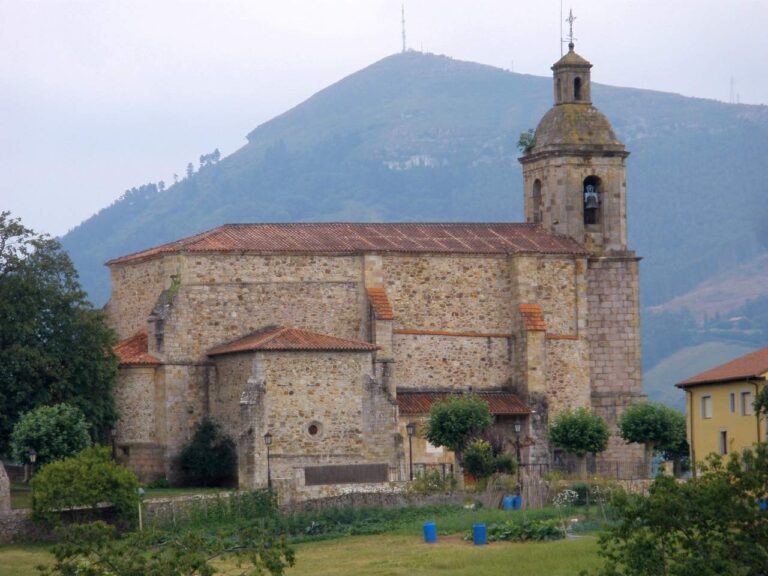
- Context image, Ongayo, Belmonte, Polaciones, 30 May 2004, CC BY-SA 3.0. The image depicts the village and landscape, not the river.