The Corvera River: from Puertu las Brañas to the Deva at La Hermida
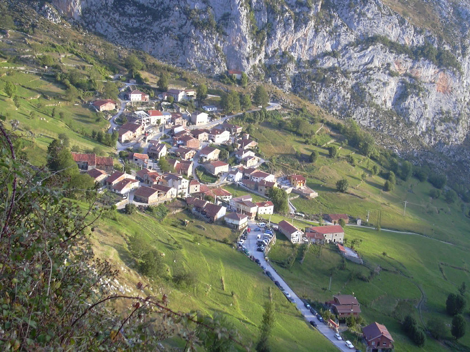
General view of Bejes, near the Corvera headwaters; the photo does not directly show the river. Photo by Hyfryd, published under the CC BY-SA 4.0 licence, Wikimedia Commons file.
The Corvera River, locally called Ríu Corvera, is the main watercourse around Bejes and a tributary of the Deva in the La Hermida gorge. It links high pastures and mountain enclosures, Bejes’s two neighbourhoods and a limestone gorge descending towards La Hermida. This guide relies especially on the Bejes Toponymy Notebook, which records local place names and landscape descriptions. It retains local names and distinguishes headwater contributions from tributaries whose status has not been established.
Source in the La Llaúna valley
The toponymic source places the headwaters in the La Llaúna valley, below the crag called El Paré Corvera, at the head of Puertu las Brañas. This is a geographical reference, not a developed spring or signposted visitor site. Regional mapping identifies the river as Corvera; no elevation or exact hydrological length is given because an official measurement of the full course has not been verified.
The upper area is a pastoral landscape of meadows, winter shelters and mountain channels. At Puertu las Brañas the river receives water from Pranieve and Pelea, names recorded in local toponymy. The source does not say whether they are permanent streams or seasonal rills, nor give the exact confluence points. They are described as headwater contributions, not as a definitive list of main tributaries.
From Bejes neighbourhoods to La Hermida gorge
After the high pastures, the Corvera crosses meadows between La Aldea and La Quintana, the two neighbourhoods forming Bejes. The La Llambre bridge crosses the river on the path connecting them and is a clear reference point for its course through the village.
The river then runs through the gorge between the channels of the Sierra de Bejes and Cuetu Cunorio. This enclosed reach descends to La Hermida, where the Corvera joins the Deva. Official water-body mapping distinguishes the Deva section between the Corvera and Sozaleras rivers; together with the local description of the confluence, this confirms that Corvera belongs to the Deva basin.
Do not confuse this Corvera with the municipality of Corvera de Toranzo or its Churrón stream; they are different places and watercourses. It is also not identified with the spring called “Manantial Corvera” in Deva-basin abstraction records: a shared name alone does not prove that it is the source of the Bejes river.
Tributaries and headwaters
The available toponymic source names Pranieve and Pelea as waters collected by the Corvera at Puertu las Brañas. The terrain also contains mountain channels and smaller rills. No hydrographic source precisely lists all direct tributaries, banks and confluences; a complete inventory would require detailed drainage mapping. Nearby streams from separate valleys or belonging to the Urdón are not added.
Places to visit beside the river
- Bejes and La Aldea and La Quintana: the two neighbourhoods help place the middle reach in a settled mountain landscape. The panorama in this guide is contextual and does not identify the river channel.
- La Llambre bridge: a documented crossing on the path between the neighbourhoods. It is a reference point for viewing the river near the village; respect local traffic and keep the crossing clear.
- Senderu la Pisa: local toponymy records a path following the river after leaving the road to La Aldea. The source does not describe an officially waymarked tourist trail or confirm its current condition, continuity, difficulty or public access. Check conditions and do not enter exposed sections without suitable information and equipment.
- La Hermida and the gorge: at the lower end, visitors can see where the Corvera valley meets the Deva valley. The gorge and slopes are steep; this guide does not recommend descending through riverbeds, pastoral channels or unmarked tracks.
Mountain paths can change with weather, livestock work and rockfalls. Avoid crossing the river at high flow, do not enter fields or pass through closed gates, and check local signs. Place names help interpret the landscape but do not replace current safety and accessibility information.
Sources
- Alberto González Rodríguez, Toponymy Notebooks of Cantabria: Bejes, PDF: entries “Ríu Corvera”, “Puente la Llambre”, “Puertu las Brañas” and “Senderu la Pisa”; headwaters, course, water contributions and local references.
- Cantabrian Hydrographic Confederation, 2022–2027 Hydrological Plan, rules and abstractions: records the “Río Deva III” water body and nearby abstractions. “Manantial Corvera” is not used as proof of the Bejes river’s source.
- Cantabrian Hydrographic Confederation, western district water-body boundaries: identifies the Deva reach between the Corvera and Sozaleras rivers.
- Government of Cantabria, General Hydrographic Network, layer 294: river name and mapped geometry of about 8.33 km; this is not presented as an official hydrological length.
- Hyfryd, General view of Bejes, CC BY-SA 4.0: contextual photograph of the village, not a direct view of the Corvera.