The Galerón River: from Montabliz to Pujayo and the Bisueña
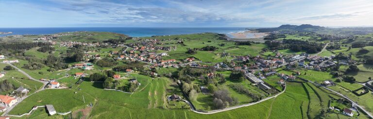
The Galerón River rises on the slopes around Montabliz, crosses the territory of Pujayo and joins the Bisueña at Prao la Ermita, in the municipality of Bárcena de Pie de Concha. The watercourse descends through a mountain valley of woodland and ravines, and forms part of the Besaya basin through the Bisueña.
Headwaters: the ravines of Montabliz
The heritage account of Pujayo says that the Galerón flows down from Montabliz, fed by ravines and streams. It does not identify a particular spring, coordinates, elevation or main source. Its headwaters should therefore be understood as a group of hillside contributions; with the available information, it would not be accurate to assign a single point as its source.
Course and confluence
From the heights of Montabliz, the river crosses Pujayo and descends towards the main valley. The heritage source places its meeting with the Bisueña opposite the former site of the hermitage of San Lorenzo, in the area known as Prao la Ermita. This hydrological relationship corrects the simplified reading found in some municipal descriptions: the Galerón is not presented here as a separate river flowing directly into the Besaya.
The Cantabrian Hydrographic Confederation groups the flood-risk area under the name “Bisueña River (plus Galerón)”, consistent with the continuity of the two watercourses before the Bisueña reaches the Besaya. Cantabria’s mapping records the Galerón place-name, but its mapped geometric length is not treated as an official hydrological length.
Tributaries
The sources consulted describe the Galerón as being fed by ravines and streams in the Montabliz headwaters. They do not provide a verified list of names or intermediate confluences. This guide does not assign nearby ravine names to the river merely because they appear close on a map.
The main downstream river connection identified is its confluence with the Bisueña at Prao la Ermita. From there, the water continues along the Bisueña to the Besaya.
What to see beside the river
Pujayo and Prao la Ermita
Pujayo is the settlement most closely associated with the Galerón. The village preserves historical references to the hermitage of San Lorenzo, whose former location is linked to Prao la Ermita and the confluence of the Galerón and Bisueña. The area helps explain the valley’s layout and rural heritage; no signposted interpretive route to the precise confluence has been confirmed.
Pujayo Viaduct and the valley
The A-67 crosses the valley on the Pujayo Viaduct, a structure spanning the Galerón hollow. It is a landscape and engineering landmark, not a pedestrian viewpoint. To observe the area, use only authorised public paths and spaces; never stop or walk on the motorway.
Mountain routes
Hiking tracks start in Pujayo and cross the foothills of Montabliz, passing over watercourses and ravines. No officially signposted municipal route following the whole Galerón has been located. Before using third-party routes, check their condition, the weather and any forestry restrictions; after rain, fords can be dangerous.
Responsible visiting
The valley combines steep slopes, woodland and mountain streams. Do not ford the river in spate or enter private land, construction areas or railway infrastructure. The viaduct is mentioned to help locate the valley; this does not authorise access to the motorway or its supports.
Sources
- Encyclopaedia of Romanesque Art / Santa María la Real Foundation, Pujayo: describes the Galerón from Montabliz, its passage through Pujayo and its confluence with the Bisueña at Prao la Ermita; it also links the area with the former hermitage of San Lorenzo.
- Bárcena de Pie de Concha Town Council, Nature: identifies the Galerón in the upper part of the municipality and links it with Pujayo.
- Cantabrian Hydrographic Confederation, flood-risk area summaries: names the area “Bisueña River (plus Galerón)” in Bárcena de Pie de Concha.
- BOE, environmental impact statement for the Molledo–Pesquera section of the A-67: identifies the Pujayo Viaduct over the Galerón valley.
- WSP, Pujayo Viaduct: confirms that the structure spans the Galerón valley; this is an engineering source, not a visitor-access guide.
- Cantabrian Hydrographic Confederation, Hydrographic Network and water bodies inventory: provides context for the Besaya basin and the Besaya–Bisueña system.
- A photograph specifically showing the river is still to be sourced and attributed under a verified reusable licence.