The Aguanaz River: karst waters from Hornedo to the Miera
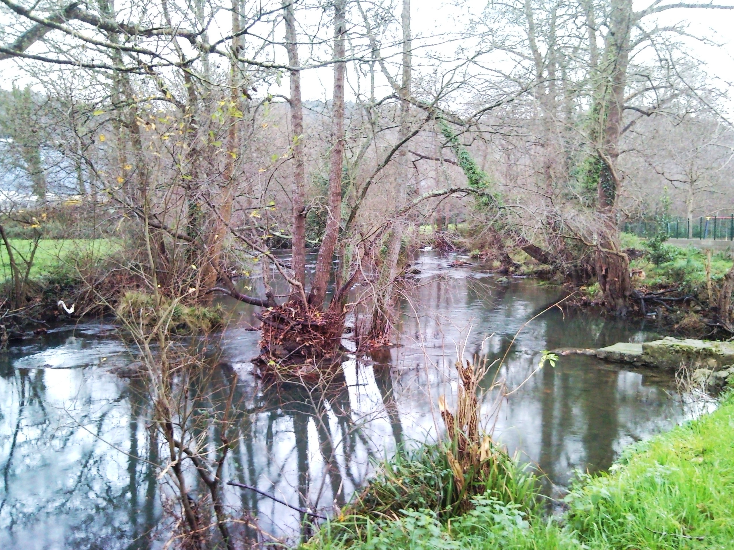
Aguanaz River at Hoznayo. Photograph by Tony Rotondas, taken on 6 January 2010 and published on Wikimedia Commons under the CC BY-SA 3.0 licence. Original file, unaltered.
The Aguanaz River, also called the Entrambasaguas River in hydrographic records, is a tributary of the Miera. The Cantabrian Hydrographic Confederation (CHC) defines a 50.3 km² basin and a length of 15.14 km for the “Río Aguanaz” water body. These figures refer to the water body defined in the 2022–2027 Hydrological Plan; other inventories give slightly different route lengths.
Headwaters of springs and karst galleries
According to the CHC’s review of water resources, the river begins in the area of El Suto, in Solórzano. Its largest visible contribution arrives farther downstream at Fuente Aguanaz, near the San Antonio neighbourhood and Hornedo, in Entrambasaguas. Water emerges from a large karst cavity and forms a visible flow. The hydrogeological study connects the spring to drainage from Alto del Portillón: the river’s headwaters near El Suto should not be confused with the spring that supplies much of its discharge.
Fuente Aguanaz supplies the Aguanaz Water Scheme, a water collection and distribution system serving several Trasmiera municipalities. This is a water-supply site: respect the facilities, do not enter closed areas and avoid any activity that could contaminate the springs.
From Entrambasaguas valley to Villaverde de Pontones
From the Solórzano and Hornedo headwaters, the river crosses Entrambasaguas and passes near San Antonio, Entrambasaguas and Hoznayo. It continues north through meadows and riverside woodland, reaches Villaverde de Pontones in Ribamontán al Monte and joins the Miera. The CHC includes Aguanaz as a distinct water body in the Pas–Miera system; more specifically, it flows into the Miera, not directly into the Cubas estuary.
The river is also part of the municipality’s economic history. The town council links its waters with the former Fuente del Francés spa, mills and the Max dietary-products factory. Water abundance, springs and hydropower supported different industrial and milling uses.
Tributaries and associated channels
The CHC cites tributary streams around Entrambasaguas and Bocarrío. At Navajeda it documents the Bocarrón stream and its tributaries La Maza and La Fuente, which join the Aguanaz before its confluence with the Miera. Mapping uses both “Bocarrío” and “Bocarrón”; these place names are kept distinct until their relationship is confirmed. No exhaustive list of minor streams is provided because the sources do not give a complete, consistent inventory.
The Aguanaz is itself one of the Miera’s main tributaries, together with the Pámanes and Pontones rivers. This relationship appears in basin planning and in documentation for the protected river area.
Places and routes beside the river
Fuente Aguanaz and the Hornedo resurgence
The headwaters and resurgence can be approached from the Hornedo and San Antonio area. The CHC locates the water-scheme intake there, so visits should remain on public, signposted spaces. Do not enter the cavity or approach water-supply equipment. Surface flow may vary with hydrological conditions.
Hoznayo and Fuente del Francés
In Hoznayo, the riverbanks and the surroundings of Fuente del Francés offer a view of the water-and-woodland landscape. The former spa, operating since the late nineteenth century, is included in Cantabria’s heritage inventory. The town council also documents mills and other productive uses linked to the Aguanaz. Check the condition of buildings, access arrangements and trail continuity locally before visiting.
Interpretive walk to Villaverde de Pontones
The environmental platform PROVOCA has described an interpretive itinerary between Hoznayo and Villaverde de Pontones, with stops at Fuente del Francés and beside the Aguanaz. The edition located was scheduled for 25 October 2026 and has already taken place. It is a route reference, not an announcement of a future event or proof that a continuously marked and passable trail is always available. Check municipal information and respect private land, water intakes and flood-prone stretches.
Confluence with the Miera
The final reach arrives at Villaverde de Pontones and meets the Miera. The area is part of the Miera protected river space. Regional legislation identifies the Aguanaz from its confluence to the bridge on the CA-652 as a conservation-interest section; that protection does not mean the entire riverbank is publicly accessible.
A river exposed to flooding and planned restoration
The CHC says some Aguanaz sections have been altered and that floodplains near settlements have experienced flooding. In May 2026, the Confederation reported that an environmental restoration and flood-defence project at Entrambasaguas was still being drafted. It must not be described as completed works.
The Confederation has also carried out maintenance on tributary channels. In 2018 it reported work on the Bocarrón and its tributaries La Maza and La Fuente before they join the Aguanaz. These interventions are part of water management and do not, by themselves, describe the current condition of every trail or riverbank.
Sources
- CHC, 2022–2027 Hydrological Plan, Appendix XIV: Río Aguanaz water-body sheet: basin area, length, system and pressures.
- CHC, review of water resources and environmental flows, “Alto del Portillón–Aguanaz” sheet: El Suto headwaters, Fuente Aguanaz and karst drainage.
- CHC, Aguanaz environmental restoration and flood-defence project: project status as checked in May 2026.
- CHC, maintenance of the Bocarrón and its tributaries: location of La Maza and La Fuente before they join the Aguanaz.
- Entrambasaguas Town Council, Cultural heritage: Fuente del Francés, mills, Max factory and river-related heritage.
- Government of Cantabria, PROVOCA: interpretive walk to Aguanaz waterfalls and Fuente del Francés: Hoznayo–Villaverde itinerary and 2026 event date.
- Government of Cantabria, Nature Conservation Act 4/2006: Aguanaz section listed as a river stretch of conservation interest.
- Wikimedia Commons, “Rio Aguanaz 1.jpg”, Tony Rotondas, 6 January 2010, CC BY-SA 3.0. Copy the original into the media folder and preserve credit, licence link and any record of modifications before publication.