The Torina River: from Alsa Reservoir to the Bárcena Gorge
A mountain headwater transformed by the reservoir
The Torina drains the slopes around Alsa and Pico Jano, between the municipalities of San Miguel de Aguayo and Bárcena de Pie de Concha. It is not appropriate to point to a single spring as the river’s source in this headwater area: water from several mountain streams gathers in Alsa Reservoir, and the Torina flows out below the dam under regulated conditions. The environmental assessment for the Aguayo expansion identifies the streams of Recuria, del Mojón, Cabecul and de la Tejera, among others, as natural inflows to the reservoir.
Official documents also describe an artificial transfer from the Aguayo or Hirvienza River, diverted upstream of San Miguel de Aguayo. This water transfer is part of the hydraulic system, not part of the Torina’s natural tributary network. This guide therefore describes a headwater catchment of streams feeding Alsa and distinguishes it from the river reach that begins below the dam.
The Cantabrian Hydrographic Confederation and Bárcena de Pie de Concha Town Council give the river’s length as approximately 6.5 km. Regional mapping represents a line of about 7.10 km. The difference may reflect how the reservoir headwater is counted and which mapping criteria are used; the two figures are kept separate, and the cartographic measurement is not presented as an official hydrological length.
From Alsa Reservoir to the Besaya
Below the Alsa dam, the Torina descends through a mountain gorge known as the Torina Canyon. The river crosses sandstone and conglomerate terrain, with wooded slopes and steep gradients, before reaching Bárcena de Pie de Concha. Near the village it receives the return flow from the Torina hydroelectric plant and, beside the settlement, joins the Besaya.
The river is strongly affected by hydroelectric use. The Alsa dam, completed in 1921 and raised in 1981, regulates the headwaters; from the reservoir, some water is carried through channels and pipes to power stations. The environmental assessment describes the Alsa channel along the left side of the valley and the return of water at the outlet of the gorge. As a result, visible flow can vary and some sections do not maintain a continuous natural regime.
The catchment also has an artificial connection with the Ebro Reservoir, as part of the reversible Aguayo system. The upper Mediajo reservoir lies in the mountains above Alsa. This infrastructure does not change the Torina’s natural membership of the Besaya basin, although it does alter how water circulates and is regulated.
Tributaries and streams flowing into Alsa
The official environmental source identifies the streams of Recuria, del Mojón, Cabecul and de la Tejera, among other smaller watercourses, as natural inflows to the reservoir. They belong to the reservoir headwater catchment: the sources consulted do not reliably reconstruct all their confluences, local names or lengths, so they are not assigned as direct tributaries of the lower river without detailed map verification.
The Aguayo River—also called Hirvienza in the cited documents—can supply Alsa through a diversion and channel. This is an artificial connection, distinct from the streams that naturally drain the reservoir catchment. Downstream, the Torina, a major Besaya tributary, joins it on the right bank at Bárcena de Pie de Concha.
What to see and do beside the Torina
- Bárcena de Pie de Concha and the Besaya confluence: the bridges in the village help visitors see how the two rivers meet. The town council identifies the Torina as a right-bank tributary and locates its mouth in the village. Respect private riverbanks and keep away from the water during high flows.
- Torina riverside path: the route is commonly followed from Bárcena towards the recreational area and the spot known as Pasá del río, on paths and tracks near the river. Available descriptions mention pools, small cascades and a wooden bridge; published distances vary according to the starting point and how much of the route is completed. The current condition, signs and access have not been confirmed: check locally before setting out, and do not cross hydroelectric facilities or barriers.
- Camino Real and the Bárcena gorges: the historic route and gorges bring visitors close to the landscape of the Iguña valley. The N-611 road and railway occupy this corridor; use designated crossings, do not stop in the road and do not attempt to walk through technical facilities.
- Pico Jano route: the Cantabria tourism leaflet describes a route from Bárcena de Pie de Concha to the summit, passing near the Alsa dam and the upper Mediajo reservoir. It gives an approximate distance of 17 km and a duration of five hours, with a substantial elevation gain and steep sections. This is a mountain hike, not a riverside stroll. Check the route and conditions before setting out.
- Alsa Reservoir and mountain scenery: the dam and reservoir are prominent landscape features, but they are part of an operating water-management facility. Do not enter restricted areas, dam crests or conduits unless signs and the responsible authority expressly allow it.
Water levels can change because of hydroelectric regulation and rainfall. The pools are not supervised swimming areas: do not swim near dams, outlets, channels or cascades, and do not assume that a path beside the river is public.
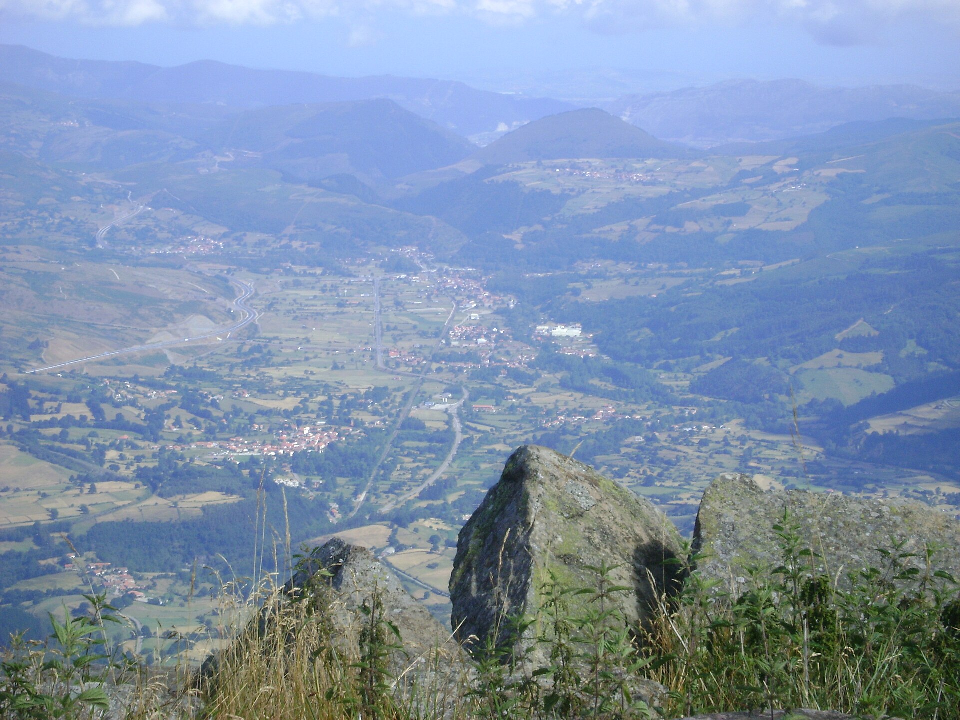
Contextual view of the Iguña valley from Pico Jano; the photograph does not show the Torina itself. Photo by Monchucantabro, 25 July 2009, licensed under CC BY-SA 3.0. Wikimedia Commons file. The locally held copy was inspected and has not been modified. Keep the author credit, source link and licence when publishing.
Sources
- Cantabrian Hydrographic Confederation, Saja–Besaya basin, hydrological study: identifies the Torina as a right-bank tributary of the Besaya, gives an approximate length of 6.5 km, and describes Alsa Reservoir, flow regulation and the hydroelectric plant.
- Cantabrian Hydrographic Confederation, Alsa/Torina reservoir factsheet: area, capacity, hydroelectric uses, and construction and raising dates.
- Official State Gazette (BOE), environmental impact statement for the Aguayo expansion: natural inflows to the reservoir (Recuria, Mojón, Cabecul and Tejera), the artificial Aguayo/Hirvienza diversion, channel and flow return, Torina Canyon and the Besaya confluence.
- Bárcena de Pie de Concha Town Council, Nature and rivers: confluence bank, approximate length, regulation and basin landscape.
- Bárcena de Pie de Concha Town Council, local routes: the Camino Real and Pico Jano route.
- Cantabria Tourism, official hiking and cycling leaflet: Pico Jano route from Bárcena and a map showing the Torina, Alsa dam and Mediajo reservoir.
- Government of Cantabria, General Hydrographic Network, layer 294: mapped river geometry, used only to compare the represented course.
- Monchucantabro, Iguña valley from Pico Jano, 25 July 2009, CC BY-SA 3.0.