The Ebro River in Cantabria: Fontibre, the Headwaters and the Campoo Route
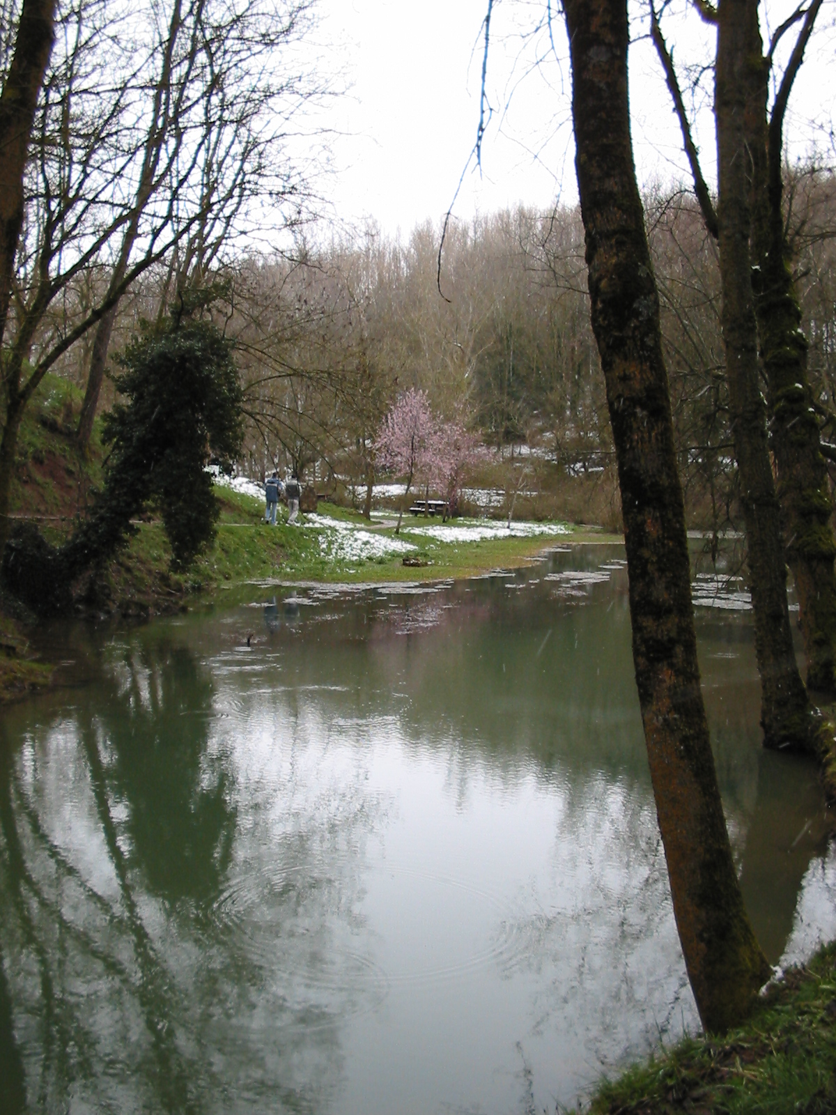
Fontibre spring, the traditional and official source of the Ebro. Photograph by Luis Javier Modino Martínez, CC BY 2.0. Image source and licence.
The Ebro crosses Cantabria in its upper course. Its official source is the spring at Fontibre, where some of the water that seeped underground from the Híjar reappears; the Híjar also continues above ground and joins the Ebro at Reinosa. This part of the region includes the Alto Campoo headwaters, the Reinosa plain and the Ebro reservoir, before the river continues through Castile and León, La Rioja, Navarre, Aragon and Catalonia to the Mediterranean. The landscape shifts from meadows and springs to open floodplains and, finally, the reservoir’s shores.
Fontibre: a visible spring and a subterranean origin
Fontibre, in the municipality of Hermandad de Campoo de Suso, is the Ebro’s official source and the place where the river emerges as a spring. Its hydrogeological origin is more complex than that of a single spring: studies by the Ebro River Basin Authority explain that some Híjar water seeps into carbonate rock and reappears at Fontibre. The Híjar is therefore a surface headwater stream, while its water is also connected underground to the spring.
Both descriptions are worth keeping in view: Fontibre is the recognised source of the Ebro and the accessible place where its surface course begins; the aquifer explains the underground contribution from the Híjar headwaters. These statements are compatible because they describe the system at different scales.
The Ebro source at Fontibre ES and the Ebro River Visitor Centre ES offer ways to see the spring and learn about the basin. The centre’s opening days and hours may change, so check them before planning your visit.
From Fontibre to Reinosa and the reservoir
From Fontibre, the Ebro flows towards Reinosa through a broad valley where several headwater streams meet. In the regional capital of Campoo, the river is part of an urban landscape of bridges, riverside walks and green spaces. South of Reinosa, it enters the Ebro reservoir, which extends across several municipalities and has a changing shoreline. The water, wetlands and meadows around the basin offer opportunities for birdwatching and walks to viewpoints; changes in the reservoir level affect the appearance and accessibility of some banks. The Ebro Reservoir Bird Centre ES and the municipality pages for Campoo de Yuso, Campoo de Enmedio and Las Rozas de Valdearroyo help visitors plan specific stops. The entire shoreline should not be treated as one continuous walking route.
Rivers feeding the Ebro at its headwaters
The Ebro River Basin Authority lists several tributaries in the headwater section as far as Quintanilla-Escalada, including the Híjar, Izarilla, Virga, Nava, Polla and Hijedo. The main streams in Cantabria that have their own guides are:
- Híjar: rises in the Alto Campoo glacial cirque beside Pico Tres Mares. It crosses the Campoo valley and joins the Ebro at Reinosa above ground. Some of its water seeps underground near Paracuelles and reappears at Fontibre. See the Híjar River guide ES.
- Izarilla ES flows from the headwaters of the Sierra de Híjar through Campoo de Suso and Campoo de Enmedio before joining the Ebro at Reinosa. Sources differ on its length, and its precise spring has not been identified.
- Polla: a right-bank tributary in Valderredible. The historic riverside trail of the Polla mills at Bárcena de Ebro ES is a heritage and walking reference that remains linked here; check current access and trail conditions before setting out.
Virga, Nava and Hijedo appear in the Ebro Basin Authority’s list of tributaries in the wider headwater area. Their precise identification within Cantabria and whether they merit separate guides still need to be checked against individual maps and hydrological records. No routes or springs are attributed to them solely on the basis of proximity on a map.
Places to visit along the river
- Fontibre: the spring and the Ebro River Visitor Centre, both in Hermandad de Campoo de Suso.
- Reinosa: walks and bridges from which to see the river in the town. Follow marked routes and observe any closures.
- Ebro reservoir: viewpoints, wetlands and interpretation spaces in the riverside municipalities. Water levels change with reservoir management and may affect access, shorelines and wildlife viewing.
- Bárcena de Ebro: a historic trail associated with the Polla River and its mills; the existing guide is a useful starting point.
- Polientes and Valderredible: use public access areas only to approach this stretch of the Ebro, and consult the Valderredible municipality guide ES before planning the route. Check local access and any closures.
Before setting out, check visitor-centre hours, closures and municipal notices. Keep away from water intakes, hydraulic works and unstable slopes, and respect nesting areas and private property.
Valderredible and the Ebro at Polientes
In Valderredible, the Ebro is the main river collecting water from a valley enclosed by mountains: most streams from its slopes flow towards it. Municipal records cite the medieval form “Val de Ripa Hibre” (“valley on the banks of the Ebro”) as one of the earliest written references to the name Valderredible in the Early Middle Ages. The river has shaped the landscape and riverside settlements, and passes through villages including Polientes.
The Ebro headwaters belong to a large basin crossing much of the north and north-east of the Iberian Peninsula. The Ebro River Basin Authority estimates a length of about 87 kilometres and a catchment area of nearly 990 km² for the section from the source to Quintanilla-Escalada. These figures refer to that section, not the entire river or Cantabria alone. After leaving the region, the Ebro continues towards the Mediterranean and receives tributaries from other autonomous communities.
Sources
- Ebro River Basin Authority, the Ebro’s source at Fontibre, on the spring and its connection with water seeping from the Híjar.
- Ebro River Basin Authority, the Ebro headwaters, for the reference section, catchment area and listed tributaries.
- Ebro River Basin Authority, Appendix 4: Fontibre and the hydrogeological system, on the relationship between the Fontibre springs and the Híjar.
- Cantabrian River Basin Authority, the reversible Ebro–Besaya water transfer, for context on water-flow management at the reservoir.
- Valderredible Town Council, municipal digital transition and competitiveness project, “Ebro River” section, on the river’s importance to the valley, “Val de Ripa Hibre” and the municipal basin.
- Wikimedia Commons, Fontibre photograph, CC BY 2.0.