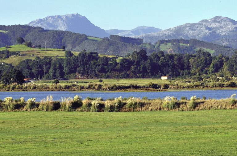
The Vendul River: from Peña Sagra to Cosío
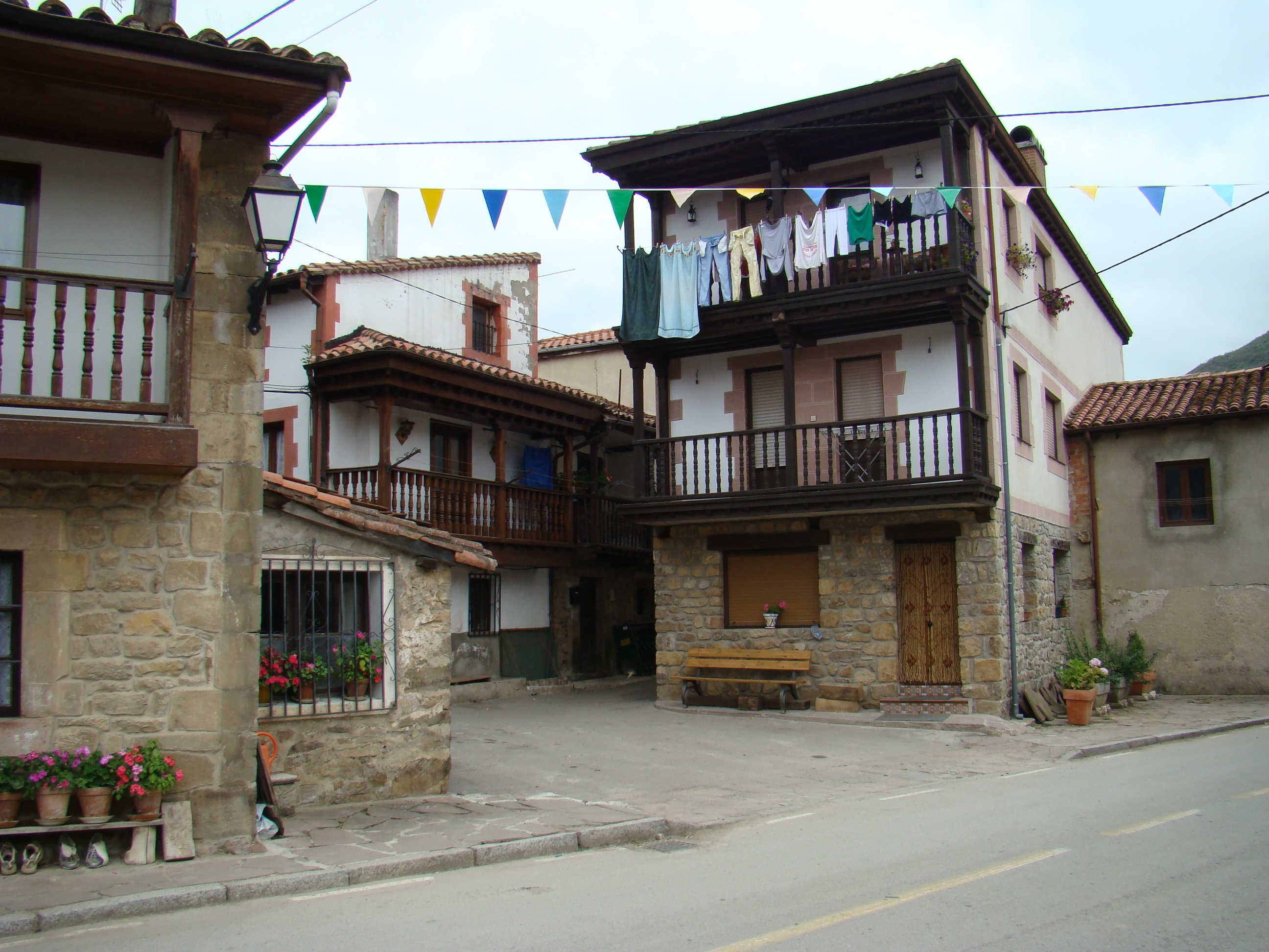
Popular architecture in Cosío, near the lower course of the Vendul. The photograph provides context for the village and does not show the river. Lourdes Cardenal, August 2008, CC BY-SA 3.0, file on Wikimedia Commons.
The Vendul is one of the main tributaries of the Nansa. It descends through the municipality of Rionansa from the northern slopes of Peña Sagra and joins the main river near Cosío. Its valley links mountain scenery, San Sebastián de Garabandal and the rural landscape of Cosío, where the river and its bridges form part of the village’s historic fabric.
Headwaters and course
A hydrological study of the Nansa basin places the Vendul’s source north of Peña Sagra, at about 750 metres above sea level. This describes the upper catchment but does not identify a spring or a precise georeferenced point. Rionansa’s municipal heritage documents also place the Hoyo de la Gándara area in the Vendul headwaters. A carved stone known as the Ídolo del Hoyo de la Gándara is preserved there. The heritage record locates it beside the Saltos del Nansa water channel; this artificial channel must not be confused with the river, and the archaeological site should not be assumed to have unrestricted public access.
From the slopes of Peña Sagra, the river descends towards San Sebastián de Garabandal. Here it receives the Sebrando River from the left, also called the Sebrando stream in some sources. The basin study explicitly identifies this tributary and gives an area of about 54 km² for the Vendul together with its tributary. The municipal planning document also assigns 54 km² to the Vendul basin. Since the two documents do not specify identical methods of delineation, the figures are reported with their respective contexts, not treated as independent measurements. A 2026 Cantabria Official Gazette notice also refers to the Tamaréu stream’s confluence when defining a fishing section. The available information is not sufficient to determine whether it should be listed as a separate tributary, so it is not included among confirmed tributaries.
The river continues north through Cosío, where it can be seen from several village bridges. One bridge leads towards the church; it is a stone structure with a single arch and a humpback profile, dated by Rionansa Town Council to the first half of the eighteenth century. Downstream from Cosío, the Vendul joins the Nansa on its left bank. The Nansa continues towards the Tina Menor estuary.
The Cantabrian Hydrographic Confederation and the regional basin study give the Vendul a length of 11.5 km. A Cantabria Official Gazette document defining a river reserve uses a length of 13.1 km. The figures refer to different documentary boundaries; this guide uses the basin study as its main reference and records the discrepancy rather than adding or averaging incompatible measurements. Both the municipal planning document and the basin study publish a catchment area of 54 km², although the latter gives that figure for the Vendul together with the Sebrando.
Tributaries: what is confirmed
- Sebrando River or Sebrando stream: a left-bank tributary that joins the Vendul near San Sebastián de Garabandal. It is the named tributary whose connection is explicitly confirmed by the basin hydrology study.
- Tamaréu stream: the 2026 fishing regulations mention its confluence with the Vendul. This confirms a junction but does not clarify the stream order and classification well enough to list it as a confirmed tributary before checking detailed mapping.
Names of channels and hollows in Garabandal’s local toponymy help describe the landscape, but they are not listed as tributaries because the sources do not demonstrate a direct connection to the Vendul for each one.
Places to visit near the river
Cosío and its bridges
The clearest documented place to view the river is Cosío. The town council recommends looking at the Vendul from the village’s bridges, especially the bridge on the path to the church. Moisés Cosío Square and its recreational area are useful landmarks; the surrounding area also offers views across the valley. These are places in the village, not a marked trail running along the whole riverbank. Respect private property and use public crossings.
The river also shaped local economic history. Rionansa’s planning catalogue records the Vendul Mill in Cosío, an eighteenth-century mill converted to electric power in 1941. The catalogue describes the building and its water system and rates its condition as fair. The heritage record explains traditional use of the river’s flow but does not confirm that the interior is open to visitors or equipped for public access.
Pozo Verde and the Garabandal area
On the route from Cosío towards San Sebastián de Garabandal, the town council identifies Pozo Verde as a natural spot associated with the Vendul and mentions bathing as a traditional use. This is a landscape reference, not a supervised bathing facility. Water level and speed, depth, slippery rocks and recent rain can change conditions. Do not approach cascades or bathe unless conditions are safe; check access and temporary signs locally.
San Sebastián de Garabandal, on the slopes of Peña Sagra, is a base for exploring the upper valley. This guide does not describe a continuous trail from the village to the source: the headwaters are mountainous, the exact spring has not been identified, and local place names do not replace a public waymarked route. Do not enter hydroelectric diversion channels, enclosed watercourses or private land.
Regulations and responsible visiting
Cantabria’s 2026 inland fishing order sets specific rules for the Vendul and Sebrando. These include a closed fishing section upstream from the Tamaréu confluence, including its tributaries, and a fishing closure on the Sebrando. It also specifies a later opening period for the lower section between the Nansa confluence and Pozo Verde. This is fishing regulation; it is not a general closure to walking or an access ban. Check the current official rules before fishing and follow local signs.
The Vendul is a mountain river and water conditions can change quickly. The bridges and public spaces in Cosío are sensible places to view it. Do not walk in the channel, use the hydroelectric canal as a path, or assume a pool is safe simply because it appears in a guide.
Sources
- Cantabrian Hydrographic Confederation, hydrological study of the Nansa basin: headwaters north of Peña Sagra at about 750 m, an 11.5 km course, the Sebrando’s left-bank confluence and the combined catchment area.
- Rionansa Town Council, Cosío, a village in Cantabria: village bridges, the bridge towards the church, Pozo Verde and views of the Vendul.
- Rionansa Town Council, 2014 General Urban Development Plan, report and appendices: a 54 km² basin and estimated contribution of the Vendul to the Nansa.
- Rionansa Town Council, heritage catalogue, Vendul Mill record: location in Cosío, chronology, uses and recorded condition.
- Rionansa Town Council, heritage catalogue, Ídolo del Hoyo de la Gándara record: location in the Vendul headwaters beside the Saltos del Nansa channel.
- Cantabria Official Gazette, Order DES/02/2026 on inland fishing: references to the Vendul between the Nansa and Pozo Verde, the Tamaréu confluence and the Sebrando fishing closure.
- Cantabria Official Gazette, register of river reserves: a 13.1 km length for the section registered as Vendul, retained as a measurement using a different boundary.
- Lourdes Cardenal, popular architecture in Cosío, August 2008, CC BY-SA 3.0. Contextual photograph; it does not show the river.