The Irbienza or Hirvienza River: from Aguayo’s beech forest to the Besaya Gorge
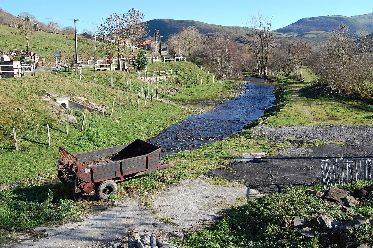
Watercourse in San Miguel de Aguayo, in a photograph titled “Río Santa María”. It provides context for the municipality and is not confirmed as a view of the Irbienza. Photograph by Bauglir, 13 December 2015, CC BY-SA 4.0. File and licence on Wikimedia Commons.
The Irbienza River—also written Hirvienza, Hirmienza or Irvienza in different sources—is a mountain tributary of the Besaya in the upper part of Cantabria’s central basin. Fed by streams from the slopes and beech woods around Aguayo, it cuts through a steep gorge with pools and cascades, passes the area of Santa María de Aguayo and continues towards the Besaya Gorges. It joins the Besaya on its left bank below Ventorrillo, near Pesquera. The sources do not agree on one precise spring, so this guide describes the headwater area rather than asserting a single source point.
Headwaters: the Hondal del Agua area
The most specific historical reference is the “IRBIENZA” entry in Pascual Madoz’s nineteenth-century Geographical-Statistical-Historical Dictionary. It says the river rises at Cepa de Aguayo and joins the Besaya a little below the Pesquera inn. The description gives neither coordinates nor altitude.
Two headwater names are used today. Local accounts gathered by walkers place the origin in Hondal del Agua, a group of small streams meeting in the beech forest above San Miguel de Aguayo. Other walking accounts identify two small pools at Campo Alto as the source, reportedly following the National Geographic Institute map. These are secondary references, and the current official map name has not been independently confirmed. Madoz, local memory and the possible map reference may describe different parts of the same drainage area; none is treated here as the definitive spring.
The upper valley is a mosaic of meadows, beech woods and upland streams. Ground can be muddy, and some user-described routes leave marked paths or cross pasture. Do not approach the pools or watershed without suitable mapping and conditions, and respect livestock gates and private land.
Course and water infrastructure
From its headwaters, the river gathers water from the slopes of San Miguel and Santa María de Aguayo. It runs down a wooded, steep-sided valley and through a narrow gorge before opening towards the Besaya Gorges. The confluence with the Besaya is on the left bank below Ventorrillo, in the Pesquera area.
The water authority operates a diversion at the Hirvienza weir near Santa María de Aguayo. A 2025 notice in Spain’s Official State Gazette authorises water to be transferred from the Besaya basin to the Ebro reservoir for public supply: up to 650 litres per second at this intake and a maximum annual volume of 2.71 hm³. This is an engineered transfer between river-basin districts, not a natural tributary of the Ebro. The river’s flow may be affected by this infrastructure and its operating conditions; the authorised maximum does not establish current flow.
Cantabria’s hydrographic layer records the name Río Irbienza and maps a course of approximately 9.19 km. This is the length of the mapped geometry, not a verified official measurement of the entire river, particularly its branching headwaters.
Tributaries and related names
Small streams forming the Hondal del Agua are mentioned in the headwaters. One walker’s route also names the Hondal del Agua stream and describes its confluence with the Irbienza. This is a field and local-toponym reference, not a complete official tributary inventory; every junction has not been checked on mapping. No other named brooks are listed as confirmed tributaries.
The Irbienza flows into the Besaya; it is not a tributary of the Torina. Aguayo also has infrastructure associated with the Ebro–Besaya transfer. This artificial movement of water does not change the river’s natural basin.
Places to visit near the river
- San Miguel de Aguayo and Santa María de Aguayo: reference villages for exploring the valley and locating the Hirvienza weir and intake. Stay on public roads and paths; do not enter water-management facilities.
- The beech forest and Irbienza gorge: beech and oak woods, pools and cascades in the middle course are the main natural features described by local sources. Routes published by users are not officially waymarked trails. Reports mention dense vegetation, pathless sections, field gates and river crossings that became impassable in high water.
- Hondal del Agua and Campo Alto: headwater areas linked to the river’s source by local and walking accounts. There is no verified official trail to a precise spring, and reaching some places may require leaving a track.
- Ventorrillo, Pesquera and the Besaya Gorges: places to approach the lower valley and the confluence area. Roads and gorge margins can be narrow and busy; do not walk in the carriageway or stop where there is no safe space.
- Roman Road Interpretation Centre, Pesquera: a cultural resource for understanding the historic Besaya corridor. It is not dedicated to the Irbienza; check opening times before visiting.
The riverside routes mentioned here are not presented as certified trails. Check weather, water levels and local path conditions before setting out. Do not ford the river or enter private land or water infrastructure.
Sources
- Pascual Madoz, Geographical-Statistical-Historical Dictionary of Spain and its Overseas Possessions, vol. IX, “Irbienza”, p. 442 (1847), digital edition, University of Alicante: historical reference to Cepa de Aguayo and the confluence below the Pesquera inn.
- Spain’s Official State Gazette, agreement on water transfers between the Cantabrian and Ebro districts (2025): names the Hirvienza, intake at Santa María de Aguayo, authorised maximums and left-bank confluence with the Besaya.
- Government of Cantabria, General Hydrographic Network, layer 294: river name and mapped geometry of approximately 9.19 km; this is not presented as a verified hydrological measurement.
- Cantabrian Hydrographic Confederation, 2022–2027 flood-risk map consultation documents: identifies the Irbienza at San Miguel de Aguayo within the Saja system.
- Centre for Mountain Studies, Shipwrecks and Groundings in the Ribamontán al Mar Council (monograph on the Besaya): places the Hirvienza sub-basin at Aguayo and its mouth downstream of Ventorrillo.
- Sur de Cantabria, Irbienza or Hirvienza River: local description of the landscape, woods, gorge and cascades; a secondary source, not hydrological mapping.
- Wikiloc, Hondal del Agua and Irbienza headwaters and walk by the river to a tributary: unofficial field observations about pools, streams and access; they do not guarantee current access or safety.
- Wikimedia Commons, Río Santa María in San Miguel de Aguayo, Bauglir, 2015, CC BY-SA 4.0; inspected contextual image, not confirmed as the Irbienza.