Eagle Point in Miengo
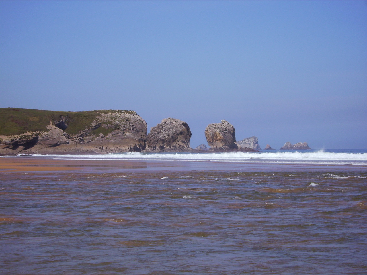
The rocks and cliffs of Punta del Águila form one of the most recognisable landscapes on the coast of Miengo.
Key facts
| Locality | Miengo |
|---|---|
| Municipality | Miengo |
| Type | Landscape |
| Access | From public areas |
What makes this place special
Its geological formations and views across the Cantabrian Sea make it a worthwhile stop for photographs.
The headland between two landscapes
Punta del Águila is a coastal headland in the locality of Miengo, at the end of a strip of land that projects into the shoreline. The Town Council’s geographical description says it separates Usgo Beach from the Mogro estuary. Within a few kilometres, the terrain brings together an open-sea beach, cliffs and the Pas estuary, making this a useful place to see how the central Cantabrian coast changes.
The headland’s interest lies in its position and views rather than in a building or visitor facility. The municipal walking leaflet includes it on routes between Miengo, Robayera and Usgo, and notes that much of the Costa Quebrada can be seen from the area. Conditions vary with the light, mist, swell and tide; a particular panorama is not guaranteed, and there is no basis for assuming that the site has a purpose-built viewing platform.
Between Usgo, Robayera and the Pas estuary
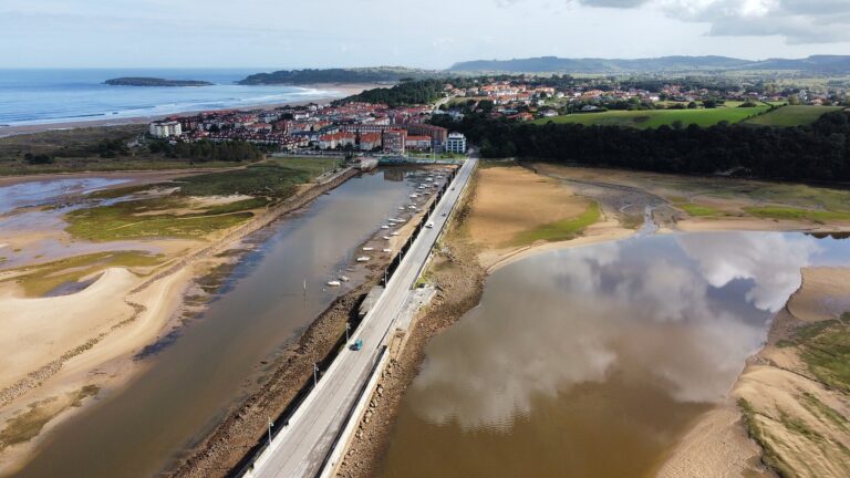
Usgo Beach lies to the west, enclosed by cliffs and exposed to the Cantabrian Sea. The Town Council warns of heavy surf, rip currents and the added danger of the cliff edges. To the east, the mouth of the Pas forms the Mogro estuary, with salt marshes, sandbanks and channels reshaped by the tides. Punta del Águila provides a visual link between these two settings and shows why this coastline is more than a uniform line of beaches.
Robayera, a small beach in the Mogro area, lies northwards towards the estuary mouth; the Town Council also describes it as part of this exposed coast. Do not confuse it with Usil, which lies inside the estuary and has different characteristics. From public paths and viewpoints, you can observe the shoreline, the Liencres dunes across the estuary and the open sea without going down onto the cliffs.
The Costa Quebrada Geopark geological map includes Punta del Águila among its mapped geological-interest sites. It places the headland within a coastline shaped by marine erosion and changes in sea level. This guide does not attribute a particular landform to a specific geological process or period where the source provides no such detail. To appreciate the scale of the scenery, compare the rocky projections, coves and beaches from several safe viewpoints.
The municipal route that crosses the headland
The Town Council’s walking leaflet describes the circular “Usgo–Robayera” route, 5.40 kilometres long, with Punta del Águila between Usgo and Robayera beaches. A second route, “Miengo–Cuchía”, links Miengo, Robayera, Usgo, Los Caballos and Cuchía in a 15.54-kilometre circuit. An earlier leaflet also includes the headland on “Beaches and Quarry”, a much longer circuit connecting several beaches, the quarries and Cudón.
These figures refer to different itineraries and should not be combined. Nor do they prove that every path is currently signposted, clear or open. Before setting out, check the latest municipal map, weather forecast, access conditions and tide. For a shorter walk, the 5.40-kilometre route is the shortest one described, but actual conditions depend on the terrain and on where you start and finish.
You can travel along the Miengo coast on paths and roads connecting beaches and neighbourhoods, but some sections have uneven surfaces and run close to cliffs. Do not describe the route as accessible or family-friendly without knowing the gradient and surface of each stretch. If the ground is wet or the wind is strong, choose a viewing point farther from the edge or postpone the walk.
Enjoy the landscape safely
Stay on public paths and keep well back from the edges. Erosion can undermine the ground, and wind strength can change near the cliffs. Do not approach the edge for a photograph, cross barriers or enter fields and accessways marked private. Do not descend to a cove along an improvised trail: the return may become difficult with the tide or swell.
If you combine the visit with Usgo Beach, check bathing conditions and safety notices separately. The municipal beach guide describes an exposed, windy shore where rip currents and nearby cliffs increase the danger. A favourable flag or sunny weather does not remove the risk of currents. Follow signs and the instructions of lifeguards when they are on duty.
Wear grippy footwear, carry water and bring a windproof layer. On longer routes, plan your return before dark and avoid shortcuts across private land or facilities. The area includes coastal and marine habitats: take your litter with you, do not pick plants, and keep your distance from birds and other wildlife. The headland is a place to observe and understand the coast, not to reach offshore rocks or approach an unstable cliff face.
Frequently asked questions
Where is Punta del Águila?
It is in the locality of Miengo. The Town Council describes it as the headland separating Usgo Beach from the Mogro estuary.
Which walking route passes Punta del Águila?
The municipal leaflet lists the 5.40-kilometre Usgo–Robayera circuit and longer coastal routes. Check the route and conditions before walking.
Can you descend from the headland to Usgo Beach?
The beach has its own access; the headland is not an equipped access point. Use marked paths only and do not descend over cliff edges or along improvised trails.
Is it an official viewpoint?
Municipal sources describe a scenic point on coastal routes, but do not document an equipped viewing platform. Stay on safe paths.
Sources and scope
The geographical location comes from the Miengo Town Council website; the route and distances come from its walking leaflets. Information about risks at Usgo is based on the municipal beach guide, and the geological reference on the Costa Quebrada Geopark map. These figures reflect published material, not the current condition of paths or facilities.
Its place in Miengo
This place is part of Miengo’s landscape and local life. It is best understood alongside other places in the locality, as the municipality brings together coast, estuaries, heritage and cultural activities within relatively short distances.
Location
It is in Miengo, one of the six localities in the municipality of Miengo. The village page lists nearby places so you can plan the order of your visit.
Planning your visit
Keep away from cliff edges and do not enter closed areas.
Frequently asked questions
Do you need to book?
For an organised activity or facility, check with its operator. For open-air walks, check access and conditions.
What else is nearby?
Miengo has other places of interest. See the locality page for coastal, cultural and festival information, keeping it distinct from neighbouring villages.
More places in Miengo
- Church of San Miguel Arcángel in Miengo
- Torre Herrera Palace or La Dehesa Palace
- Amparo Rial House in Miengo
- Peñas Blancas Palace in Miengo
- El Somo Palace in Miengo
This page is part of Miengo.
Return to Miengo or the Miengo municipal guide.
Sources: Miengo Tourism Plan ↗, Miengo Town Council · history and location of the locality ↗, Miengo Town Council · municipal route leaflet ↗, Miengo Town Council · walking leaflet ↗, Miengo Town Council · Usgo Beach ↗ and Costa Quebrada Geopark · geological map and sites of interest ↗.