The Cubo River: waterfalls and woodland in the Cosgaya valley
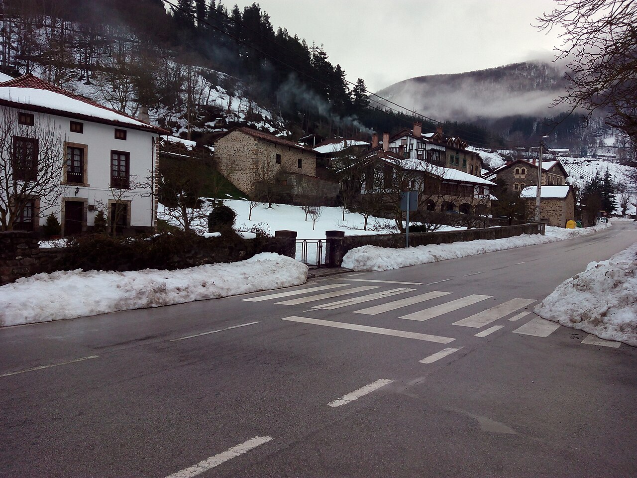
Cosgaya, in the municipality of Camaleño. A contextual image of the valley and its villages; it does not show the Cubo River. Photograph by Asturkian, 15 February 2015, CC BY-SA 4.0. File and licence on Wikimedia Commons.
The Rejo River joins the Cubo in the upper part of the valley; the continuity is represented by the exact contact between their geometries in the regional hydrographic layer. See the Rejo River guide, which distinguishes documented tributaries from small streams whose relationship remains unresolved.
The Cubo River is a mountain watercourse in the upper Deva basin, in the municipality of Camaleño. It descends through a narrow, wooded valley to Areños, a neighbourhood of Cosgaya, where it flows into the Deva. In its lower kilometres, the gradient and rocky bed create cascades and small waterfalls, especially when rainfall and snowmelt sustain the flow.
Headwaters between Peña Llesba and Prao Cubo
No official source has been found that marks a single point of origin. Manuel Pereda de la Reguera’s geographical account describes the Cosgaya–Coriscao path alongside the Cubo, says that the trail climbs along its course, and mentions a spring and a cabin called Prao Cubo. A local Valdebaró place-name study connects the headwaters with Praocubo and the mountain ridge between Llesba and the Porciles pass. The boundary between the Cubo and Calabacedo river basins is also described in the Picos de Europa National Park planning documents.
These sources place the headwater area on the slope descending from Peña Llesba towards Prao Cubo, but do not prove that the spring at the mountain pasture is the hydrological source. This guide therefore gives no source elevation or coordinates. The upper slopes are mountain terrain; the cited spring should not be taken as an equipped spring or guaranteed visitor access.
Course to the Deva
From the upper hollows around Prao Cubo, the river descends through the Cubo valley across wooded slopes and pastureland. It heads north towards the floor of Valdebaró valley. At Areños, below Cosgaya, it joins the Deva. Pereda de la Reguera’s book and local geographical information agree on the confluence; the National Park boundary uses the Cubo valley as a reference for describing the divide with the Calabacedo.
Cantabria’s hydrographic inventory records the name “Río Cubo”. The mapped geometry is approximately 2.86 km long, but this is the length of the mapped feature, not an official hydrological measurement; unnamed headwaters may not be included under that label.
Tributaries and nearby watercourses
The local place-name documentation mentions the El Gustal stream on the lower slopes of Monte de Cubo, near its confluence with the Cubo River. This suggests a local tributary, but the source gives no coordinates or formal hydrological description; its exact junction still needs confirmation on detailed mapping.
The Rejo River is a mapped tributary of the Cubo. The Caojoso and Gustal streams are associated with its nearby headwaters; consult the Rejo guide for the status of each confluence and route-named watercourse.
No reliable list of other named tributaries has been found. Small streams crossed by trails or shown on upper-valley maps are not added as tributaries without confirming continuity and confluence. The Calabacedo is a neighbouring watercourse in a separate basin, whereas the Deva directly receives the Cubo at Areños.
What to see beside the river
- Cosgaya and Areños: these villages are the main reference points for reaching the valley and locating the confluence with the Deva. Cosgaya preserves traditional houses and a granary included in the cultural heritage inventory; the image accompanying this guide shows the village and is identified as contextual.
- Cubo River waterfalls: a circular walk described by hikers follows part of the lower river from Cosgaya. The published route is about 8.5 km, with around 400 m of ascent, and includes bridges, waterfalls and a track for the return. This is a third-party account, not an officially waymarked route; check the route, crossings and current trail conditions before setting out.
- Upper valley and Prao Cubo: woodland, meadows and high pastures help explain how the river gathers water from the Llesba slope. The spring and cabin mentioned in the literature are place-name references, not access recommendations. This guide does not suggest following the riverbed to the headwaters without a currently verified route.
- Cosgaya–Coriscao path: the historical description follows the river upstream from Areños towards Prao Cubo and Puerto de Cubo. It is a mountain route with steep slopes and a continuation to high elevations, not a short riverside walk or a trail confirmed as currently signed.
- Deva River and Las Ilces Beech Forest route: Spain’s Ministry for the Ecological Transition publishes information on official PR-PNPE 26, a 10.4 km circular walk between Espinama, Pido and Las Ilces, near the Deva and the Pierga track. It is an option in the same basin, but it does not follow the Cubo.
Mountain streams can rise quickly after rain or snowmelt. Do not cross fords in high water, respect closures and signs, and check trail conditions locally. The waterfall route mentioned here comes from a hiking account and does not guarantee that every section is open or safe.
Sources
- Manuel Pereda de la Reguera, Liébana y los Picos de Europa (1972), digital edition: describes the Areños reach, confluence with the Deva, climb alongside the Cubo, and the spring and cabin at Prao Cubo.
- Pascual Rivas Carrera, Monterías de Valdebaró, pp. 12–14: documents Praocubo, the Cubo River and the local relationship of El Gustal stream to the confluence; it interprets mountain boundaries and is not a hydrographic survey.
- Government of Cantabria, General Hydrographic Network, layer 294: records the name Río Cubo; the approximate geometric length (2.86 km) is not presented as an official river length.
- Spain’s Ministry for the Ecological Transition, Picos de Europa Natural Resources Management Plan: describes the ridge separating the Calabacedo and Cubo basins and the descent towards Cosgaya.
- Spain’s Ministry for the Ecological Transition, PR-PNPE 26: Las Ilces Beech Forest route: details an official route near the Deva, not a Cubo riverside path.
- JFCamina, Cubo River waterfalls from Cosgaya: field report and proposed circular route; a secondary source, not official certification or a guarantee of current access.
- Photograph: Asturkian, Cosgaya, Cantabria, CC BY-SA 4.0. The image is contextual and does not show the Cubo.