The Río Bo and the Valcayo Gorge
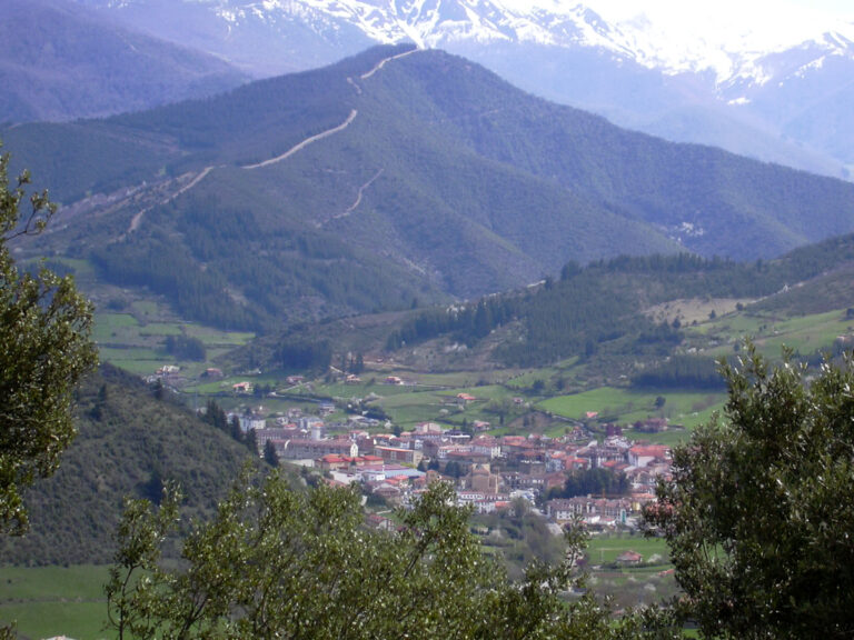
The Río Bo is a small mountain stream in the Cereceda valley, in Vega de Liébana. It descends the Valcayo slope through beech and oak woods, narrows into the gorge named after it below Peña de Dobres, and joins the Río Frío. Although short, the ravine and surrounding woodland form a distinctive landscape in eastern Liébana.
Headwaters and course
The Government of Cantabria’s hydrographic mapping represents the Río Bo as a separate watercourse about 3.76 kilometres long. Local itineraries describe its upper valley on the slopes of Collado Cezura and its descent through beech forest towards Valcayo. However, it has not been possible to confirm which of the small springs in this headwater area is the exact source. This guide therefore treats the pass and beech woods as landmarks in the headwater area, not as a verified spring.
The stream descends towards Valcayo, identified administratively with La Vega in the municipal guide. Higher up it crosses woodland and meadows; farther down it forms the Hoz del Río Bo, a narrow passage beneath Peña de Dobres. The mapped drainage network shows it joining the Río Frío, which carries its water towards La Vega and then flows into the Quiviesa. From there, the water system continues into the Deva.
Tributaries
The sources consulted do not provide a reliable list of named streams flowing directly into the Río Bo. Small rills and hillside runoff feed its headwaters, but no names are assigned based merely on proximity on a map. The confirmed connection in the drainage network is with the Río Frío, of which the Bo is a tributary.
Places to visit along the course
- Valcayo: the nearest settlement and a reference point for approaching the valley. Cantabria’s official list of forest tracks includes the route named «Valcayo–Río Bo» among tracks open to general circulation. This confirms a mapped access track, but does not guarantee that the whole route is open to pedestrians or in good condition.
- Hoz del Río Bo: the enclosed stretch can be viewed from mountain paths in the area. Hikers’ accounts describe demanding routes, stream crossings, steep gradients and sections without a clear path. This is not a prepared family walk, and a descent to the river should not be improvised.
- Collado Cezura and the beech forest: these provide landscape landmarks for the upper valley. Some user-submitted tracks link Cucayo, the pass and Valcayo, but they are not presented here as official routes. Before setting out, check maps, weather, ground conditions and any track restrictions.
- Río Frío and Vega de Liébana: the guide to the Río Frío explains the receiving stream and its continuation towards the Quiviesa. The municipal guide to Vega de Liébana brings together information for planning a visit to the valley.
The stream runs through woodland and mountain terrain. Damp ground, mud, steep slopes and rising water can make fords and paths unsafe. Respect forest-track rules, closures and livestock activity; do not enter the riverbed or continue if the water level has risen.
Photography
A photograph that clearly shows the Río Bo, has a reusable licence and has a verified location still needs to be added. Photos of other streams are not reused to illustrate this river.
Sources
- Government of Cantabria, General Hydrographic Network, layer 294: name, mapped geometry (3,755.54 m) and geometric link to the Río Frío; map topology is not a substitute for a field hydrological survey.
- Official Gazette of Cantabria, list of forest tracks open to general circulation in Vega de Liébana: includes the «Valcayo–Río Bo» track; it is not a hiking guide or confirmation of current conditions.
- Wikiloc, Cucayo–Dobres–Collado Cezura–Río Bo–Valcayo route: personal account describing the beech forest, gorge and river crossing; used as a local reference, not an official route or safety guarantee.
- Wikiloc, circuit through the Cereceda valley and Río Bo gorge: a second independent account of the valley and its connection with Valcayo.