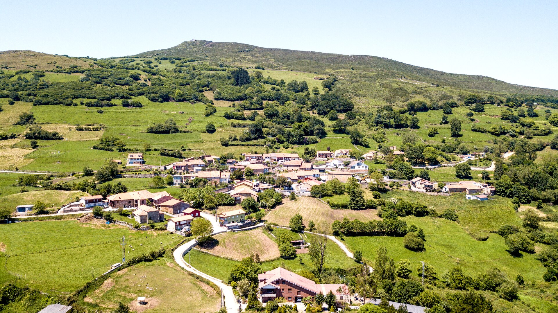
The GR-73 crosses the Besaya basin, roughly following the historic corridor of the Blendios Road.
Key facts
| Locality | Collado |
|---|---|
| Municipality | Cieza |
| Type | Route |
| Access | Check route and trail conditions |
History and details
The Cieza tourism page explains that the trail arrives from the Iguña valley via Collado Piedrahita, descends towards Villayuso, continues through the La Rueda neighbourhood and climbs to Collado before heading down towards Los Corrales de Buelna. This is a route across several municipalities; this page does not attribute the entire historic road to Cieza.
The Roman road and the GR-73 are connected, but they are not the same thing: the marked trail is a modern route that roughly follows the old corridor. Some archaeological sections survive as remains; others are not visible or coincide with later paths and roads.
The route can be planned in stages. Check current maps and markings, road crossings, return transport and local notices. Do not enter private property or remove stones from protected sections.
Plan your visit
Long-distance route; plan the stage and return transport.
Route and safety
Check the route, terrain and weather before setting out. A map is a guide, not a substitute for current mapping.
A long-distance route through the basin
The GR-73, known as the Blendios Road, crosses the Besaya basin from north to south and passes through Cieza as part of a route linking several municipalities. The local tourism description says it enters from the Iguña valley via Collado Piedrahita, descends towards Villayuso, passes through La Rueda and climbs to Collado before continuing towards Los Corrales de Buelna. This sequence shows how the valley villages connect to a larger walking corridor.
The present trail and the historic road
The name GR-73 refers to the old Blendios Road, but the route marked today and the archaeological remains are not the same thing. The modern route roughly follows the corridor traditionally associated with the road between Pisoraca, Iuliobriga and Portus Blendium. In some places there are remains of paving; elsewhere the trail follows later paths, roads or tracks. The municipal website describes this relationship as approximate, so do not assume that every section of the GR preserves Roman paving.
Cieza as a stage of the route
Within the municipality, the route connects the river landscape with the villages of Villayuso and Collado. Passing through La Rueda and climbing to the upper village offers views of the valley from different elevations. Do not assume local roads are comfortable for walking: watch for traffic and use the relevant marked trails or paths. If you plan to walk only part of the GR-73, check your start and finish points, as the stage may not form a loop and rural public transport can be limited.
Trail markings and navigation
Long-distance footpaths are generally marked with red and white waymarks, but works, vegetation or storms can alter the signs. Carry a recent map, consult the trail manager’s information and check junctions before setting off. Do not follow an old downloaded route without checking for diversions. Take care on roads, wear reflective items when visibility is poor and avoid walking in a group that occupies the whole carriageway. If a path is closed, do not try to bypass the closure through private property.
Heritage along the way
The GR-73 can be linked with the Fresneda mountain track, whose remains are listed by the Town Council near Collado. It also passes villages with churches and historic homes, including San Tirso in Villayuso, San Juan Bautista in Collado and several manor houses. These places add interest to the stage, but no permanent visitor hours are published for their interiors. Plan stops from public spaces and contact the Town Council or parish if your visit depends on entering a building.
Terrain, weather and pace
The route combines valley paths, climbs and sections beside roads. Rain can create mud and make stones slippery; heat and exposure on some sections also require planning. Check the forecast, carry water and food, plan your return and do not judge the day by kilometres alone. Groups with children, older people or limited walking experience may need to split the route. The municipal description does not give a complete duration for the GR-73 through Cieza, so no time estimate is invented here.
A route across several municipalities
The GR-73 continues beyond Cieza and forms part of a regional corridor linking valleys and settlements. This continuity explains its historical and landscape interest, but also means that stage notices may come from different town councils and trail managers. Check information for each section and plan transport between municipalities. A stop in Cieza is not a complete visit to the historic road, and monuments or services in neighbouring areas should not be attributed to Cieza.
Planning a balanced stage
Before starting, decide how many kilometres you want to cover and where you will finish. Check transport options, connections from the endpoint to your accommodation and alternatives in case of a diversion. Linear stages need more planning than a loop returning to the same village. Carry enough food and water for the expected duration, and do not rely on cafés or shops that may have limited hours. If walking in a group, agree on a shared pace and a regrouping point after junctions or road sections.
More to see in Collado
This page is part of the Collado guide, where you can find the other places, routes and celebrations assigned to this settlement.
- Casa de Ortiz in Collado
- Hermitage of San Bartolomé in Collado
- Church of San Juan Bautista in Collado
- Fresneda mountain track in Collado
Back to Collado or to the whole municipality of Cieza.
Sources: Check source ↗ and Check source ↗.