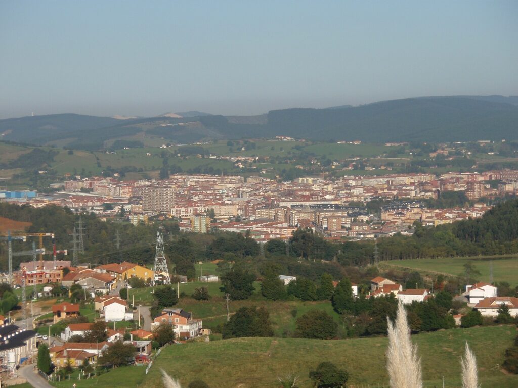
Complete guide to the municipality of Torrelavega
Torrelavega is best understood as a municipality made up of a city and villages. The Town Council lists the city and nine localities: Barreda, Campuzano, Dúalez, Ganzo, La Montaña, Sierrapando, Tanos, Torres and Viérnoles. The municipal capital has its own guide so that its urban centre is not confused with the whole municipal area. Torrelavega City and Its Nine Villages.
The city grew as a commercial, livestock and industrial centre where the Saja and Besaya rivers meet. Its squares, civic buildings, churches, markets and cultural venues tell different parts of that story. The villages offer a different scale: rural architecture in Viérnoles, industrial history in Barreda, and riverside and hillside landscapes around the edges of the municipality.
The municipal Pasea Torrelavega guide suggests cultural walks lasting an hour and a half, three hours or a full day, as well as industrial and nature itineraries. Its maps are useful for locating places, but some show old projects, private facilities or footbridges whose conditions may have changed. Each guide distinguishes what can be viewed from public space and does not assume that an interior or path is open without recent confirmation. Pasea Torrelavega: industrial heritage guide and Pasea Torrelavega: natural heritage guide. Browse the places to see in Torrelavega.
La Lechera preserves the memory of the Montañesa Sugar Factory and the former Trade Fair Centre. In 2026, the Town Council was still announcing its cultural transformation and the gradual relocation of schools, so it is not described here as a fully open cultural centre. La Viesca is a natural area restored on former mining land. The latest information found, published on 6 October 2026, said that the suspension footbridge remained closed and the La Barquera crossing was still restricted. Check current notices before planning a route that depends on these crossings.
Local festivals, markets and cultural events round out a visit, but schedules and programmes change. Traditional dates help explain the municipal calendar; for a specific edition, check the Town Council programme. The National Statistics Institute’s Gazetteer confirms ten singular entities and their populations as of 1 January 2025. Population figures in the guides are attributed to that source and date; since 2024 the INE has calculated them from the Annual Population Census.
Explore Torrelavega
- Villages in the municipality
- History and heritage
- Nature and parks
- Routes and walks
- Markets and festivals
- Plan your visit
Shared places and routes
Some resources, routes and celebrations do not belong to a single locality. The Sierra del Dobra, the Besaya Greenway and riverside areas cross municipal boundaries; the Federico Ceballos Memorial moves between villages in Torrelavega. The individual guides distinguish what is confirmed and link the localities involved.
Sources and further information
- Pasea Torrelavega: industrial heritage guide
- Pasea Torrelavega: natural heritage guide
- Clavis catalogue record
- Torrelavega Council: study of Jarramaya Fortification
- Torrelavega Council: Solvay Ensemble concerts in tribute to Federico Ceballos
- Torrelavega Council: Misa Criolla at the Church of the Assumption
- Torrelavega Council: Misa Criolla at Santa María de Barreda
- Torrelavega Council: Misa Criolla at Virgen de las Nieves in Tanos
- Solvay Ensemble: Misa Criolla concert
- Solvay Ensemble choir
- Torrelavega Council: Pasea Torrelavega
- Pasea Torrelavega: cultural heritage
- Pasea Torrelavega: cultural heritage map
- Torrelavega Council: festivals
- Torrelavega Council: fairs and markets
- Torrelavega Council: precautionary restrictions on La Viesca footbridges
- Cadena SER: La Viesca footbridge restrictions, 6 October 2026
- Official State Gazette (BOE)
- Torrelavega Council: Marzas festival
- Spain’s National Statistics Institute: population gazetteer
- INE: gazetteer methodology