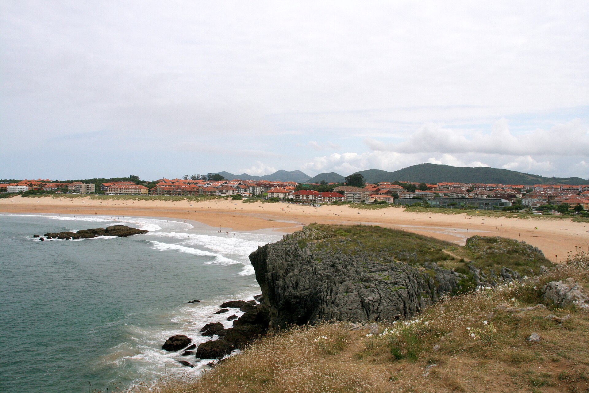
A long beach beside Joyel Marsh
Ris is one of Noja’s main beaches, opening onto the Cantabrian Sea at the western edge of town. Spain.info describes it as an urban golden-sand beach about 2,200 metres long and roughly 100 metres wide, often windy with moderate waves. These are reference figures from a tourism listing, not daily measurements: tides change the visible width and conditions vary.
At its western end, the beach meets the surroundings of Joyel and the Ris neighbourhood. The coast and marsh lie close together but are different habitats: the beach is a changing environment of sand, dunes and surf; the inland wetland has waterlogged areas, vegetation and sensitive wildlife. A 2009 environmental resolution placed the Ris dune system within the Santoña, Victoria and Joyel Marshes Natural Park and Natura 2000 sites. In 2026, the Coastal Authority identifies the Government of Cantabria as the park’s management body. Observe the transition from public access points; do not create shortcuts through the dunes.
Dune ridge and restoration
A 2009 environmental file described a dune ridge at Ris about 1,400 metres long and 50 metres wide on average. These are technical figures from the project at that time, not a current survey. The document helps explain why dunes need protection: they form a natural barrier, hold sand and support plants adapted to mobile, salty, windswept ground.
The restoration project described in the file proposed passive willow sand traps, sea couch planting on the primary dune and marram grass on the secondary dune, fencing to limit trampling, raised boardwalks to concentrate foot traffic and information panels about the ecosystem. It also proposed removing the invasive plant Carpobrotus edulis and monitoring the plantings and dune ridge. The 2009 resolution required coordination with the protected-area managers. This is a record of the project’s design, not confirmation that every feature remains in place. Use signposted entrances and boardwalks, respect fences and signs, do not walk on vegetation or pull plants, and take rubbish with you. A closure protects the dune system; do not go around it over the ridge. Wind can shift sand and destabilise paths, so follow beach staff guidance and keep clear of slopes and fenced areas.
A coastal walk towards Trengandín
Ris and Trengandín form a coastal sequence through different parts of Noja’s shoreline. A 2006 environmental impact assessment documented a project to restore the Ris seafront and create a pedestrian path between Ris and Trengandín. Measures considered included organising routes into one coastal path, restoring damaged public-domain areas and improving pedestrian access. The assessment records planning at that time, not the current surface condition, continuity of every section or possible closures. Check signs and conditions before walking. You can choose an open section and return the same way; sand, steps or uneven surfaces may occur, and the tide affects the shore but not necessarily the designated path.
Services and activities: check what is operating
Spain.info lists toilets, showers, foot-wash stations, cleaning, sunbed hire and water-sports equipment among Ris services. Actual provision depends on the season and can change; the listing does not guarantee that every service operates year-round.
For 2026–2029, the Coastal Authority authorised seasonal facilities and services for Noja’s beaches. At Ris, the resolution includes marked surf areas, an access channel for kayaks and paddleboards, boardwalks and dune-protection fencing, lifeguard posts and toilets. It authorises up to 70 sunbeds and 20 umbrellas for hire in the eastern sector. It also lists a summer car park with 44 spaces, including three reserved for people with reduced mobility and one for an ambulance. This sets authorised uses and capacity; it does not confirm daily hours, availability or that all installations are in place on every date. Check municipal notices for the current season.
Water-use zones are organised to separate bathing, surfing and boat access. Marked areas and channels may be seasonal and supervised by lifeguards. Do not swim across a boat channel or enter a surf zone where signs separate it from bathing. For kayaking, paddleboarding or lessons, ask the school or beach staff about the authorised launch point, sea conditions and daily restrictions.
Plan your visit
The tide changes the available sand and can expose rocky outcrops. Check a reliable tide table; avoid slippery rocks and places where rising water could cut you off. Spain.info’s description notes frequent wind and moderate surf as general characteristics, not a forecast. Follow flags, warnings and lifeguard instructions in preference to a guide or photograph taken on another day.
Ris can be busy in summer. Arriving early, using marked entrances and keeping service roads clear helps visitors and emergency access. Seasonal parking and beach posts may operate under specific rules or fees; confirm they are operating before relying on them. If you need an accessible route, check which boardwalks and facilities are actually available that day: a multi-year authorisation is not proof of effective accessibility.
The beach can be enjoyed without swimming: walk along the shore, watch the profile change with the tide and view the dunes from permitted paths. For birdwatching, use designated paths and viewpoints near the marsh, keep your distance and avoid resting and nesting areas. Quiet behaviour and respect for closures help protect Ris.
Nearby places
Ris is part of the guide to what to see in Noja and connects with entries for Trengandín Beach, Joyel Marsh and the coastal route ES. Each is a different place; proximity on a map does not mean they share access, opening times or visiting conditions. Also see Helgueras Beach, Victoria Marsh, the Noja town guide or the municipality guide.
Sources: Spain.info beach guide ↗, 2009 environmental resolution on the Ris dune system ↗, 2006 coastal path environmental assessment ↗, 2026–2029 seasonal-use authorisation ↗ and authorised seasonal beach facilities document ↗.